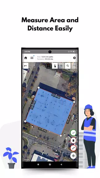
Mapulator: Your Essential GPS Field Measurement App! Need to measure anything from farmland to hiking trails? Mapulator simplifies measurements with 5 versatile tools, calculating area, distance, and radius directly on the map. Customize line styles, choose from multiple map views (satellite, terrain, street), and leverage GPS Live tracking for instant, accurate results. Effortlessly export and share your projects. Download Mapulator today and streamline your measuring tasks!
Key Features of Mapulator:
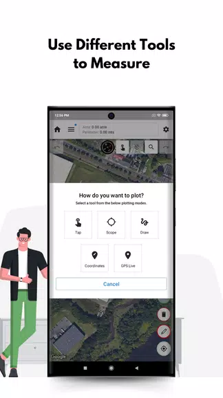
❤ All-in-One Measurement: Five powerful tools handle area, distance, and radius calculations, providing a complete measurement solution.
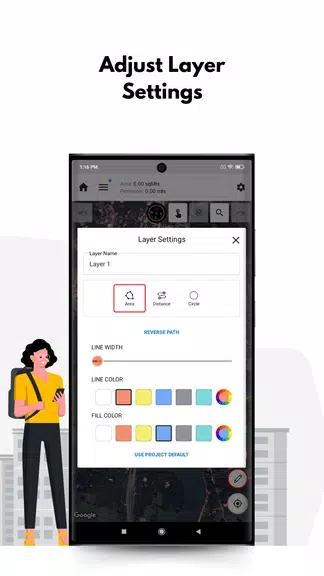
❤ Personalized Precision: Customize line width, color, and fill color to match your needs and preferences.
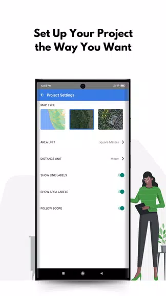
❤ Multiple Map Perspectives: Select from various map types – satellite, terrain, or street view – for optimal visualization.
❤ Real-Time GPS Tracking: GPS Live tracking offers dynamic measurements as you move, ideal for fieldwork.
User Tips & Tricks:
❤ Organized Layering: Utilize multiple layers to keep your projects organized and measurements clearly separated.
❤ Precise Location Pinpointing: Employ the location search to quickly find specific locations for accurate measurements.
❤ Seamless Sharing & Exporting: Easily share or export your completed projects for collaboration or record-keeping.
Final Verdict:
Mapulator is an intuitive and powerful GPS measurement app, perfect for professionals and hobbyists alike. Its comprehensive features, customization options, and real-time capabilities make it an indispensable tool for anyone requiring precise on-the-go measurements. Download Mapulator now and experience the difference!